Shadeline

Features

What Shadeline does today, screen by screen.

Shadows in 3D

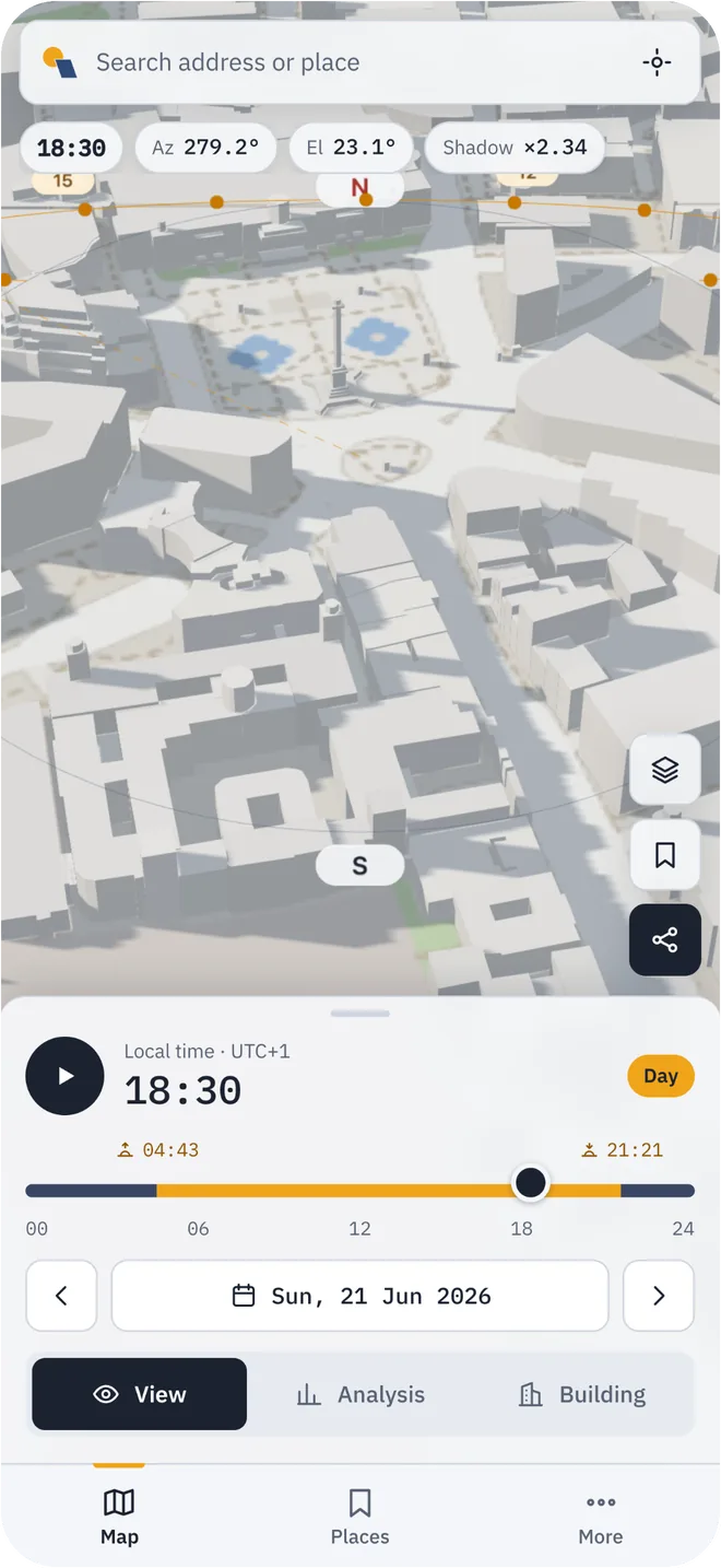
Buildings and hills cast shadows on streets, roofs and facades, the way they do outside.

  • Buildings from OpenStreetMap, raised to their mapped height
  • Terrain from open elevation data, so hills and valleys shade too
  • The sun’s path and a compass drawn over the map
Shadeline on a phone: a 3D map of a city square with building shadows, the sun path and a time slider

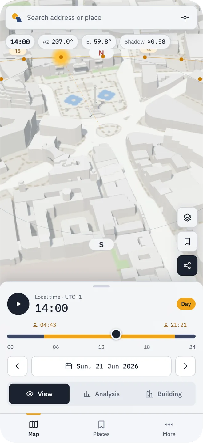
Any day, any hour

Drag the time slider or press play to run the day. Jump to a solstice or an equinox, or pick any date, past or future.

  • The local time of the place you are looking at, wherever you are
  • One-tap dates: 21 March, 21 June, 23 September, 21 December
  • Adjustable playback speed
Shadeline in the evening: long building shadows across the streets and the time set to 18:30

Every sun time

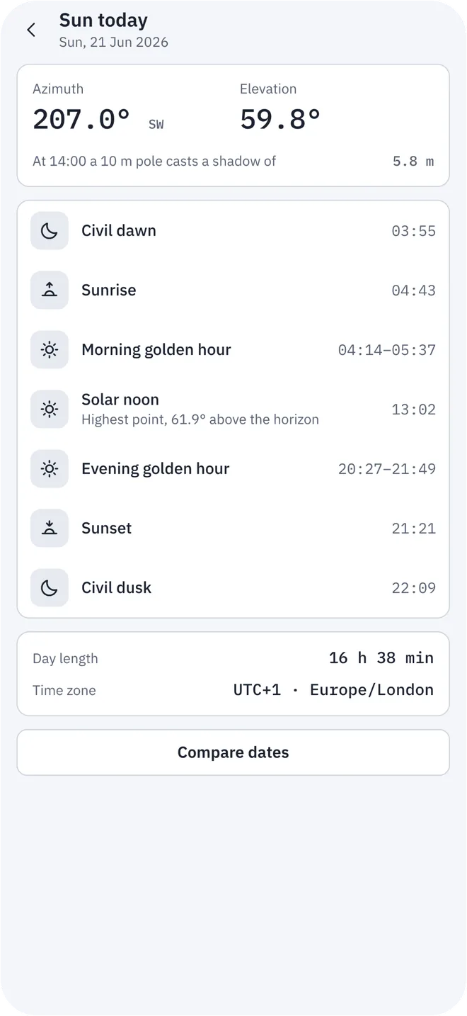
Sunrise, sunset and solar noon, with civil dawn and dusk and the morning and evening golden hours.

  • Azimuth and elevation at the chosen moment
  • Day length and the highest point of the sun
  • Solstices and equinoxes side by side
Sun table in Shadeline: civil dawn, sunrise, golden hours, solar noon, sunset and day length

Sun-hours map

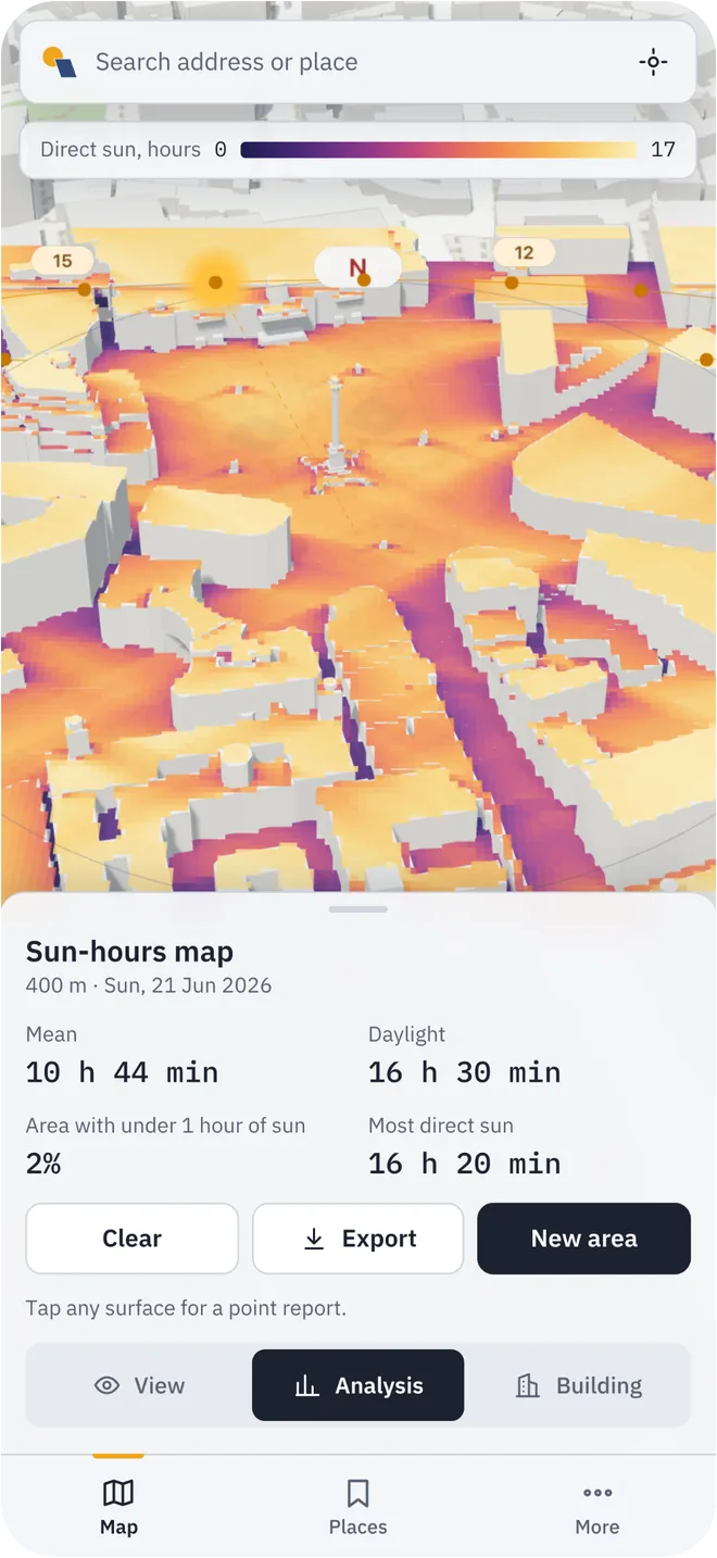
Colour an area by the hours of direct sun each point gets on the day you choose.

  • Areas of 200, 400 or 800 metres around the view
  • The sun is sampled every 10 minutes from sunrise to sunset
  • The average, the longest exposure and the share of the area with under one hour of sun
Sun-hours heat map in Shadeline: streets and roofs coloured by hours of direct sun

Point report

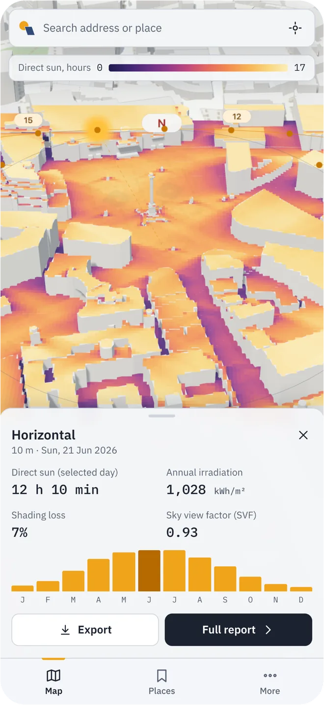
Tap the ground, a roof or a facade and get the figures for that exact surface.

  • Direct sun on the chosen day and sun hours over the year
  • Annual solar irradiation in kWh/m², month by month
  • Shading loss and sky view factor
  • Export as CSV
Point report in Shadeline: direct sun, annual irradiation in kWh/m², shading loss and a monthly chart

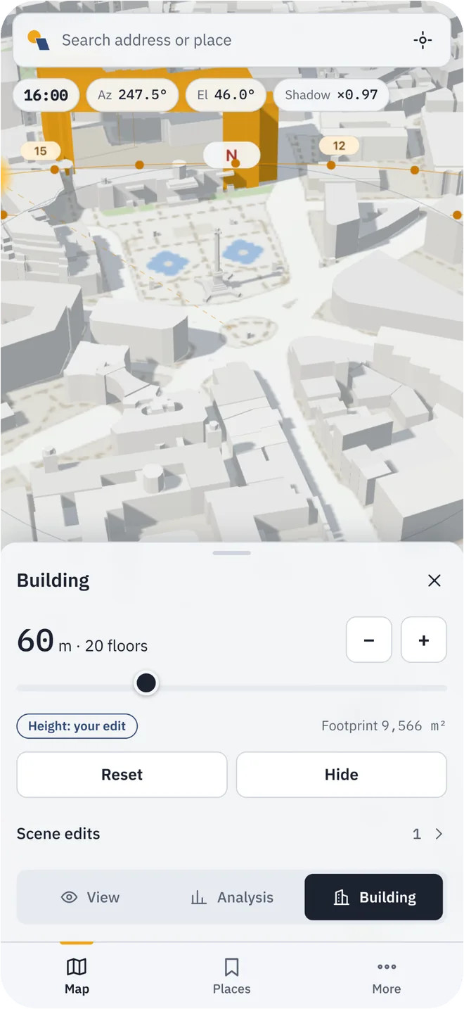
Try a change

Raise, lower or hide a building and see what it does to the light around it.

  • Height in metres, with the number of floors alongside
  • A default height for buildings the map has no height for
  • Your edits travel with the link you share
Building mode in Shadeline: a building raised to 60 metres casting a longer shadow

Share a view

A link opens the same place, camera, date, time and building edits for anyone.

  • Short links for messages and email
  • No account needed to open one

Saved places

Keep the views you come back to: a flat you are considering, a building site, a favourite terrace.

  • Stored on your device, not on our servers
  • Reopens with the same camera and time

On any screen

A desktop layout for work and a phone layout with one-hand controls.

  • English and Azerbaijani
  • Light and dark themes
  • Needs a browser with WebGL 2

Saved places, the full sun table and the comparison of dates are in the phone layout for now.

Look at your own street

It takes a few seconds and there is nothing to install.

Open the map